Big Bend (http://www.nps.gov/bibe/index.htm) is huge, approximately 1,200 square miles of Chihuahuan desert. The southern boundary of the park is the Rio Grande river. Over the river, is Mexico.
My first trip to Big Bend was some years ago. We were tent camping and spent some nights at primitive sites, me sleeping with a big rock by my pillow in case there were any inquisitive bears or hungry javelinas.
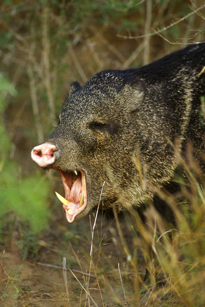
This is a javelina. This is also how I imagine their approach might be as I'm sleeping in a tent.
They roam in groups. So their approach might be like this, times 12.
Andrew and Ben had driven down the day before and hiked Emery Peak; the highest point of the Chisos Mountains.

.JPG)

View, taken by Andrew, from Emery Peak
Saturday morning, we spent a few minutes admiring Andrew's new white topper on the truck, and we aptly renamed the truck Papa Smurf.

The first hike we took led us to Cattail Falls. Sometimes, if you're lucky and willing to explore, you can find wonderful hidden treasures in the desert. Cattail Falls turned out to be a hidden oasis of full, green trees, small pools of water and lots of fallen rocks for the kids to climb. It's not on the official trail map for Big Bend, perhaps so as not to encourage too much traffic in this area.


We found this really cool old tree about half way to the falls.
Then we heard a phantom swarm of bees and moved on.


It's a children's playground :)

Perfect spot for a picnic. Or, a granola bar and some peanuts.


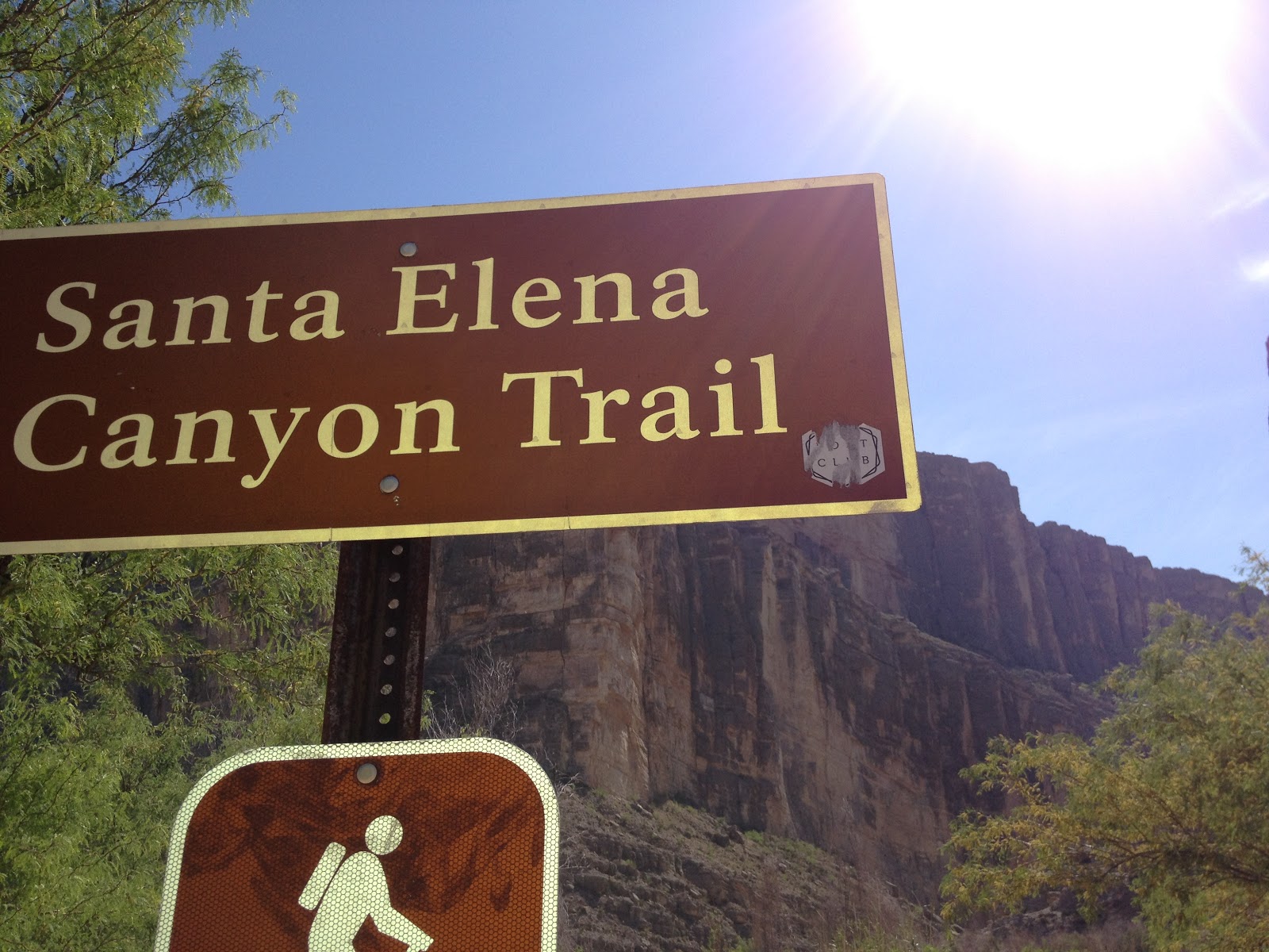
Later that day, we decided to head to Santa Elena Canyon. I've been here a couple of times in the past, but I never tire of it. The Rio Grande river cuts through this Canyon and marks a clear divide between the U.S. and Mexico. In some areas of Big Bend, you can swim in the Rio Grande and watch the local Mexicans watering their donkeys on the other side of the river bank.
On this trip to Santa Elena Canyon, we were reminded, by a man with a badge, that we were not permitted to cross over the river to Mexico. We could go in the water, but stay on the U.S. side. Apparently, this strict rule applies, even if you have a child that needs to pee and the Mexican side has bushes.
.JPG)
Mexican mesa
.JPG)
Staying on U.S. soil
.JPG)
The canyon
.JPG)
Later, in the bookstore, I read a story about two rangers who went primitive camping up on the U.S. mesa you see to the right. After warming themselves with a campfire and a bottle of rum, one of the rangers left camp to, ahem, relieve himself. He fell over the side of the cliff and was killed. Many hiking/camping deaths occur this way. Moral of the story is find a bush (an American bush).
.JPG)
cheese
We hiked up on the trail and came back down to the river edge. The girls found some mud.
Lots and lots of mud. Which turned out to be sinking mud.
.JPG)
"Okay, but don't get your clothes dirty"
.JPG)
"Oh bother, well, okay, but don't get your shirts dirty"
.JPG)
.JPG)
"Hair, no mud in your hair!"
.JPG)
"Now you all have to walk home"
.JPG)
.JPG)
Bathing (on the U.S. side of the river)
As Andrew, Ben and Hannah walked back on the trail, the rest of us swam back in the Rio Grande.

These people are not us. They should not be that close to Mexico.
That night, we ate at the Starlight Theater in Terlingua Ghost Town ( http://ghosttowntexas.com/). Terlingua Ghost Town is one of my favorite places in this area. It is an old abandoned town, home of the old Chisos Mining Company. When mining for mercury shut down, the workers walked away almost overnight, leaving their homes to ruin. Now, the town features a saloon, a restaurant, a large porch, a coffee bar, and a few renovated brick homes. It also hosts an annual chili cookoff. Last time we were here, we rented a cute cabin and met a man who spends his days scouring for remnants of the old town. He appeared to live in a house with no roof.

That night there was live music in from Austin. And a slightly creepy drunk lady who seemed mesmerized by the six little girls sitting at our table.
Later that night we sat outside and stuffed 2,361 plastic eggs with jelly beans.
The next day we headed to Rio Grande Village. We remembered it being somewhat of an orchard, and so perfect for an Easter egg hunt!
.JPG)
.JPG)
The man in the background is stealing jelly beans. He answers to "Andrew".
.JPG)
Rio Grande Village is a nice spot to camp in Big Bend. It offers a range of sites (including full hook ups), has a store, and is not too far from Boquillas Canyon Trail, where you can end your hike with a swim in a nice stretch of river.
After the hunt was over, we headed out to Ernst Tinaja. (A tinaja is a hollow in a stream bed, which collects water and can remain full, long after the river bed is dry). Tinajas can be deadly to an animal looking for a drink as they can fall in and not be able to get themselves out. I suspect the same is true of silly human beings.
After a short drive with a truck bed full of girls and jelly beans, we arrived at the trail head.
.JPG)
.JPG)
.JPG)
.JPG)
.JPG)
Shade!! The heat can make you overlook fragile layers of rock hanging over your chosen shelter.
.JPG)
.JPG)
This is a fold in the rock. Even though I asked the two geologists on our trip, I'm still not clear on how a rock folds; why doesn't it just break? Maybe the layer was folded when it was still sand? Extreme pressure?
.JPG)
Ernst Tinaja. You can go further up the trail and find more tinajas, but I believe this is the biggest one in this location.
.JPG)
Everyone became a rock climber
.JPG)
You can see a child teetering above the tinaja on a ledge and another running along the slope leading to the tinaja. One of them is mine.
.JPG)
.JPG)
As you can see, I was fully poised to catch the baby, should she fall toward the death trap.
Next, we took the no-shade Hot Springs trail. This trail passes through the remains of a resort and homestead, down passed the river to the hot springs which sits on the Rio Grande.
.JPG)
.JPG)
Mary of the desert
.JPG)
.JPG)
Here are the springs. The water is surprisingly hot.
(Or, I suppose, not, if you know you're going to "hot springs")
.JPG)
Andrew, soaking his weary Emery Peak feet
.JPG)
"Okay, but don't get your clothes wet..."
.JPG)
.JPG)
.JPG)
"whatever..."
.JPG)
.JPG)
On the drive back, we wondered what these mountains were, on the Mexican side of the border. Maybe part of the Sierra Madre Oriental range?
That night, we ate at the Chisos Mountain something-or-other. I forget the name, but it's basically the only restaurant in the Chisos Basin, unless you count a shrink-wrapped sandwich at the store. The drive to the basin is pretty, up the mountain roads and then down into the bowl of the Chisos mountains.
.JPG)
Drive up into the Chisos

Sunset from the patio of the no-name restaurant, looking through the Window
Last time we were here, we hiked to the window and looked out passed a sheer cliff over the desert. No time for that this time, a five mile hike was not likely to get a yay vote from anyone at the end of this busy day. We said goodbye to our friends as they started their trip back home, and we headed back to our motel.
Our last day, we hit Mule Ears. Andrew hiked most of the trail before realizing that the closer you got to the mule ears, the worse the view became as you could only view one side. Mary and I lagged behind due to (wet) shoe issues.

Mule Ears looks like mule ears! Clever.


leeezard

.JPG)
.JPG)
This was quite a large snake and Mary promptly told us it was a Red Racer (she was working on her junior ranger badge so knew of such things). While it was still alive, it flailed in the road like a whip.
So, Mary earned another junior ranger badge. This was a tough one; the ranger grilled her for a full 10 minutes.
.JPG)
I love Big Bend. It's a difficult place to get to, but 4 hours from Midland is far better than the 10 hours it used to take driving from Houston. At this time of year, you see a more lively version of the Chihuahuan desert, with flowers blooming and green leaves on the typically barren trees and cacti.

.JPG)
.JPG)
.JPG)
.JPG)
Flowering ocatillo! Who knew these were anything but pointy desert sticks?
Here are some examples of Big Bend in bloom. If you look closely enough while wandering through a desert, you'll find it's not as sterile and fruitless as it first appears. When I first came to Big Bend in 2008, it was a scary place. Not least because of the bears, mountain lions and javelinas, but also because it seemed so dry and lifeless. With few facilities, you keep a close eye on the gas tank and hope you don't end up stranded in the middle of nowhere after the sun has set. You can easily feel vulnerable here, especially if you veer of the paved roads. But there is life here, there are orchards and streams and plants and flowers and beauty.


.JPG)
.JPG)
.JPG)
.JPG)
.JPG)


